by lhnav_emailmarketing_wpadmin | May 18, 2014
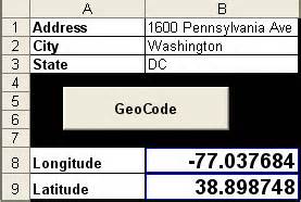
Geocoding Plotting Addresses and other spatial information from attribute tables Geocoding Definition from Wikipedia > Geocoding is the process of finding associated geographic coordinates (often expressed as latitude and longitude) from other geographic data, such...
by lhnav_emailmarketing_wpadmin | May 18, 2014
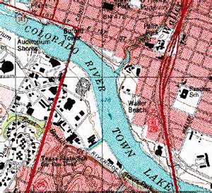
Image Geo-referencing/Rectification Adding GCP to Raster Images Image Geo-Referencing /Image GeoRecitification Working with Images (Map and Charts) Digital or Paper Scanned and putting them in the proper place on a map It is pretty easy and straightforward to use QGIS...
by lhnav_emailmarketing_wpadmin | May 4, 2014
PyQGIS Python Scripting pyqgis developer cookbook PyQGIS, the blending of QGIS and Python to extend and enhance your open source GIS toolbox. With PyQGIS you can write scripts and plugins to implement new features and perform automated tasks....
Recent Comments