Geocoding
Plotting Addresses and other spatial information from attribute tables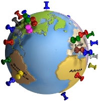
Geocoding
Definition from Wikipedia > Geocoding is the process of finding associated geographic coordinates (often expressed as latitude and longitude) from other geographic data, such as street addresses, or ZIP codes (postal codes). With geographic coordinates the features can be mapped and entered into Geographic Information Systems, or the coordinates can be embedded into media such as digital photographs via geotagging.
Reverse geocoding is the opposite: finding an associated textual location such as a street address, from geographic coordinates.
There are two QGIS Plugins for Geocoding your data (Geocoding and MMQGIS)
In addition, you can use other Web Services and bring in the completed product to QGIS.
Use Google Fusion Tables to perform GeoCoding and generate a KML and add that to QGIS.
Geo-Coding Tutorial with Screen Shots
Tutorial from http://blog.mangomap.com/
MMQGIS Plugin Home Page
MMQGIS Plugin for QGIS
Bing Maps Key http://www.microsoft.com/maps/create-a-bing-maps-key.aspx
Google Geocoding https://developers.google.com/maps/documentation/geocoding/
https://support.google.com/fusiontables/answer/2571232
- Go to Google Docs. Sign in to your Google Account or create a Google Account if you don’t already have one. (Note that you while can use a Google Apps for your Domain account for Fusion Tables, you will not be able to create maps.)
- Click the “Create” button.
- Click the “Connect more apps” bar at the bottom of the resulting list.
- Type “fusion tables” in the “Search Apps” box and hit the “Enter” key.
- Click the blue “+ CONNECT” button, then click the “OK” button in the confirmation dialog box.
- Click “Create > Fusion Table (experimental)”.
- In the Import new table dialog box, click “Choose File”.